Geodetic Engineers meet at VSU
- Details
-
Published: 30 August 2013
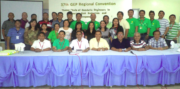
Some 100 members of the Geodetic Engineers of the Philippines (GEP) convened on March 30-31, 2012 at the VSU's Center for Continuing Education during its 37th GEP Regional Convention.
The convention centered on the theme "Role of Geodetic Engineers in Disaster Risk Reduction Management." The occasion gave an opportunity for the GEs to have an exchange of ideas on current issues and concerns affecting engineers.
In his welcome message on behalf of VSU President, Dr. Jose L. Bacusmo, Prof. Alan B. Loreto, Executive Officer, informed the body about VSU being known not only in instruction but also in research. He cited the three big research centers, the Philippine Root Crop Research and Training Center which does research on major rootcrops like camote, cassava, taro and yam; National Coconut Research Center – Visayas which main thrust is for the improvement of the quality of coconut in the region and in the country, in general; and the National Abaca Research Center which is the only research center in the Philippines doing research in abaca. He also encouraged the participants to go to the research centers to see what other things the University does.
On the other hand, Engr. Carlos E. Cordero, GEP President in Region 8, expressed his gratitude to the University administration along with the geodetic engineers of the institution and the Advance Geodetic Engineering Society for hosting the convention.
Engr. Cordero explained the passage of Republic Act No. 10121 also known as the Philippine Disaster Risk Reduction and Management Act of 2010 which is an actualization of the Millennium Development Goals (MDGs) that form a blueprint of what has been agreed by all the world's countries and its leading development institutions. He stressed that the contribution of land professionals to achieving the MDGs is central and vital with the provision of relevant geographic information in terms of mapping and databases of natural environments, as well as providing secure system for land use management and development.
Engr. Cordero also emphasized that land professionals have an important role in directing land administration system to support effective land use management. He said that this underscores development and forms the "backbone" of environmental sustainability. Thus, "no development will take place without having a spatial dimension and no development will happen without the footprint of the land professionals."
Engr. Cordero pointed out that the traditional skill of a geodetic engineer, like quality awareness, is a valuable contribution and can help support the quality assurance of spatial data and of spatial information processes. In the field of land information systems, geodetic engineers possess a sound experience in maintaining huge spatial databases at a very high level of reliability. This knowledge can be used to support the implementation of spatial information systems which provide for an absolutely indispensable base for the effective disaster risk management.
Among the different topics discussed during the convention include: Application of ICT in Land Administration and Management; Disaster Risk Reduction Management: A Case Study in Brgy. Guadalupe, Baybay City; Updates on Land Registration and Titling; Geodetic Engineers' Role in Climate Change Adaptation and GE Consultancy; Updates on Mobile Information Technology for Professional Practice; RA 9184 (Government Procurement Reform Act); and Land Policies: Cadastral Projects in Region 8.